


linchamps. 2025.05.30

trusgnachjf
User
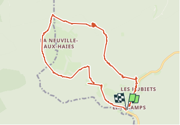

Length
11.5 km

Max alt
470 m

Uphill gradient
327 m
Km-Effort
15.9 km

Min alt
203 m

Downhill gradient
328 m
Boucle
Yes
Creation date :
2025-05-30 11:50:40.982
Updated on :
2025-05-30 15:00:58.418
3h09
Difficulty : Difficult

FREE GPS app for hiking
 SityTrail
IGN / Geographical institutes
SityTrail Plus
The world is yours!
About
Trail Walking of 11.5 km to be discovered at Grand Est, Ardennes, Les Hautes-Rivières. This trail is proposed by trusgnachjf.
Positioning
Country:
France
Region :
Grand Est
Department/Province :
Ardennes
Municipality :
Les Hautes-Rivières
Location:
Unknown
Start:(Dec)
Start:(UTM)
631888 ; 5530408 (31U) N.
Comments